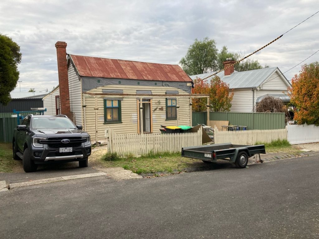
7.3 Recognising and protecting the miner’s cottage
For over a decade, miner’s cottages were afforded little protection; their large block size, a feature of the miner’s residence area legislation, made them ideal for speculative redevelopment. In 2005 the Bendigo council commissioned Robyn Ballinger, a local heritage historian, to make a preliminary study of the ‘Ironbark’ region.[1] This preliminary study recognised the importance of the area and alerted planning authorities to the need for more detailed research. Conducted by Amanda Jean, who was also the heritage advisor for the City of Greater Bendigo, the Ironbark study was commissioned in 2007 and released in 2010.[2] It was an exemplary study. With considerable experience in vernacular architecture, Amanda Jean conducted the first detailed field investigation of the area. Unlike earlier studies, her investigation paid particular attention to materials and modes of construction of the houses. In addition to physical examination, she undertook extensive archival investigation, employing rates books to date houses and locate biographical details of the occupants. This archival research was contextualised with secondary sources on the social history of the mining industry and the history of 19th-century migration.
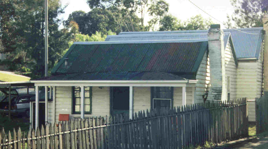
Amanda Jean’s statement of significance blended an assessment of the historical and architectural importance of the area. It recognised the importance of the miner’s residence area in providing ‘homes of the working-class miners who serviced some of the wealthiest deep quartz mines of Bendigo and Eastern Australia’. Their preservation provided an ‘insight into the domestic lives and typical homes of Cornish and German miners, some of whom worked in the related trades as blacksmiths, engine drivers, carriers and mine engineers’. Architecturally the significance also lay in their diverse range of housing styles, including the ‘typical Cornish vernacular long house’ and the ‘combined use of timber weatherboards and pisé rammed earth forms of construction associated with the German community’.[3]
In 1993 writing an environmental history was a new feature of heritage studies; in 2009 Heritage Victoria formalised the writing of environmental histories with its Framework of Historical Themes. In line with these themes, Robyn Ballinger and Colin Pardoe wrote a new environmental history of Bendigo in 2013.[4] Their brief extended beyond the Borough of Eaglehawk and the City of Bendigo to encompass additional rural areas and country towns incorporated into the City of Greater Bendigo in 1994. The themes set out by Heritage Victoria provide a common framework for conducting heritage studies across the state, and Ballinger and Pardoe wrote an elegant overview of the development of the built environment of Greater Bendigo. However, the Framework of Historical Themes encourages a broadbrush approach and sidelines environmental features peculiar to specific regions. The new environmental history rightly pointed out the importance of the residence area (with very limited discussion of its origins and evolution) yet ignored the way it shaped housing or how residence areas were distributed across the city.[5]
In 2020, heritage planners at the City of Greater Bendigo commissioned Amanda Jean to study mining cottages with the intention of providing a ‘serial listing’ of houses that would capture houses not covered in existing heritage overlays. Amanda Jean in her study of Ironbark drew on my research into Cornish migration and asked me to help her in researching the history of the evolution of housing on the Bendigo goldfield. Our study was the first detailed investigation of the legislation covering residence areas, and we used rate assessment books – a previously neglected source – to plot the geographical spread of residence areas and the social composition of residence area holders. Our study also used diaries and probate inventories to examine the way cottages and houses were first built and later extended. From the morphological evidence of the historical report Amanda Jean argued:[6]
Serial listing of the typology of miners’ houses seems justified particularly as visual context affects aesthetic experience. The heterogeneric character of development on former auriferous land tends to visually obscure the 19th century miner’s house. The potential for continual infill development is high.
To aid the identification of the housing stock of the goldfields, and based on the historical report, Amanda Jean identified three distinctive house styles:[7]
- Quartz gold boom miners’ houses – simple modest timber frame, weatherboard and hip roof houses associated with the 1870s mining boom and associated with the Mines Act 1865, the Residence Areas Act 1881 and the Residence Areas Amendment Act 1884.
- Workers’ and mine speculators’ housing – more opulent housing provided by an expansion of the residence area legislation which opened auriferous land for habitation by non-miners, manual and skilled workers and women. This resulted from further liberalising of the residence area legislation.
- Quartz reefer houses – houses built in the early colonial regency architectural style by aspiring speculators and quartz reefers who took advantage of 1865 legislation to purchase Crown land at competitive auction.
Amanda Jean’s typology gave strong grounds for reassessing many of the houses scattered through the goldfield and identified as early as 1993 by Butler and Ward but not included in heritage overlays.
In response to this study the council commissioned the Victorian Miners’ Housing Serials Listing – Stage 2 Study, which was undertaken by Trethowan Architecture and completed in November 2021. Using the categories developed by Amanda Jean, further detailed fieldwork and additional archival research, this study examined 158 houses across the city. In November 2023 the City of Greater Bendigo announced that it had examined the investigation of Trethowan Architecture and adopted the planning scheme amendment C275gben, to ‘protect different types of miner’s houses built during Bendigo’s gold rush era’. Of the 158 houses examined, 147 were added to existing planning schemes and given heritage protection. Commenting on the amendment, Mayor Andrea Metcalf said the aim of the amendment was to protect and enhance the cultural heritage of Greater Bendigo for future generations:[8]
Heritage shapes our identity and connects us to our past, our city, and region and this amendment will continue to protect our rich heritage through the Heritage Overlay in the Greater Bendigo Planning Scheme which lists those places that are locally significant.
These houses are indeed locally important; they are also important material reminders of 19th-century global migration and the quest for a new and better life.
- Districts in Bendigo were often named after creeks, rises and valleys. A precise definition of the Ironbark region is difficult. It was named after a hill and a gully. Ironbark and Long Gully were essentially one area, adjoining New Chum. Modern roads have cut through this area, dividing locations that were one large residential and mining area in the 19th century. ↵
- Jane Amanda Jean, Ironbark Heritage Study 2010 (City of Greater Bendigo, 2010). Volume One. Volume One provided the thematic history. ↵
- Amanda Jean, Ironbark Heritage Study 2010, Volume Two, Citations, 9–10. ↵
- Lovell Chen, Architects & Heritage Consultants, Thematic Environmental History: Final Report (City of Greater Bendigo, June 2013). The authors were Robyn Ballinger and Colin Pardoe. ↵
- Lovell Chen, Thematic Environmental History. For the discussion of the residence area see p. 114. The photographs are a great feature of this report. ↵
- Amanda Jean and Fahey, The Evolution of Housing on the Bendigo Goldfields: A Case for Serial Listings, 5. ↵
- Amanda Jean and Fahey, The Evolution of Housing on the Bendigo Goldfields: A Case for Serial Listings, 6. ↵
- City of Greater Bendigo, “Planning Scheme Amendment to Protect Miners’ Houses Adopted at Council,” (press release, 21 November 2023). ↵
